Fly tab
Record the flight
Start from a plan or from the Fly tab, planned or not. The app records the times, the take-offs and landings and the GPS track.
Situational awareness only. Not for primary navigation.
Recording
A flight, start to finish
Off-blocks when you start and on-blocks when you finish. In between, take-offs and landings are found from your GPS speed.
What it does
- Start from a plan with Fly This Plan, or from the Fly tab, planned or not.
- If a take-off or landing is missed you can mark it yourself, and correct the times afterwards.
- The flight's Live Activity on the Lock Screen, and its status on your Apple Watch.
- A notification if the GPS signal is lost.
How it works
Step by step: a flight
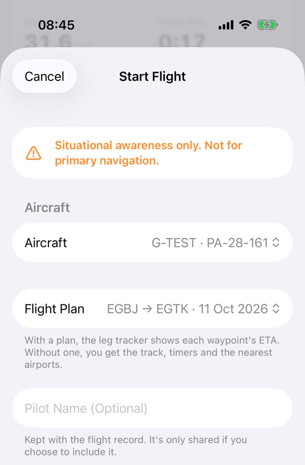
Step 1 of 8
Start Flight
In the Fly tab, open Fly and tap Start Flight, or tap Fly This Plan in a plan. Choose the aircraft and the plan. The first time, read the note about mounting your device and turn on I Understand.
Step 2 of 8
Off-blocks
Tap Start Flight (Off-Blocks Now). The app asks to use your location while it records, and the block time starts.
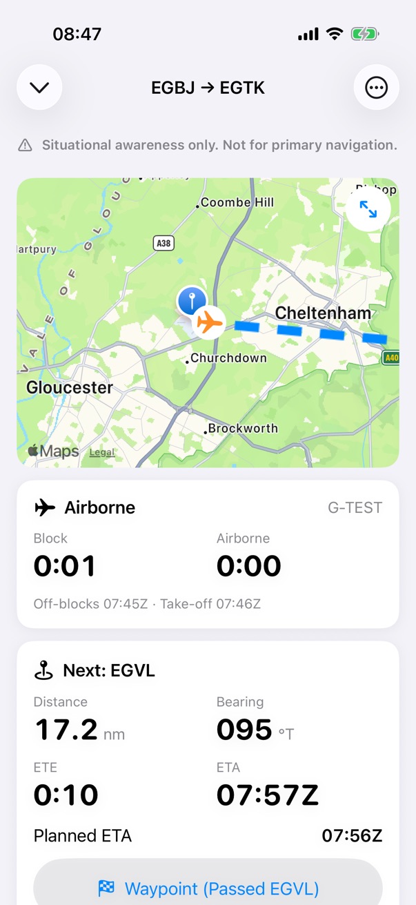
Step 3 of 8
Take-off
The take-off is detected from your GPS speed, and the airborne time starts.
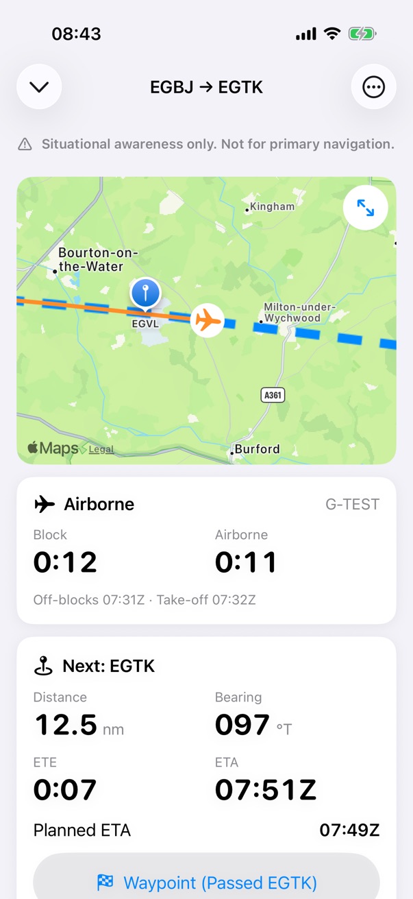
Step 4 of 8
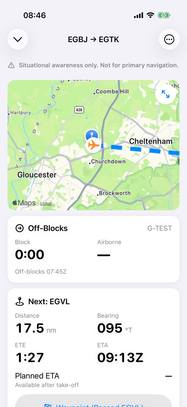
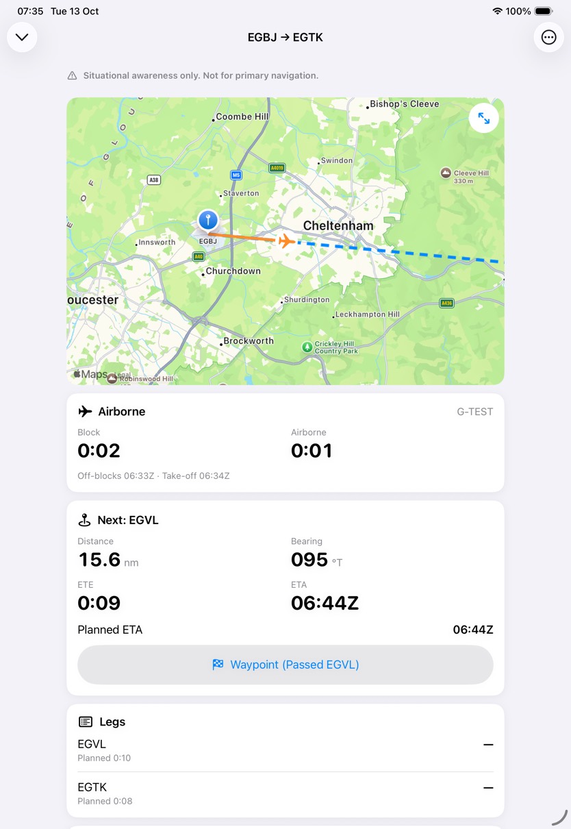
En route
The next waypoint's distance, bearing, ETE and ETA, and the planned heading from your PLOG.
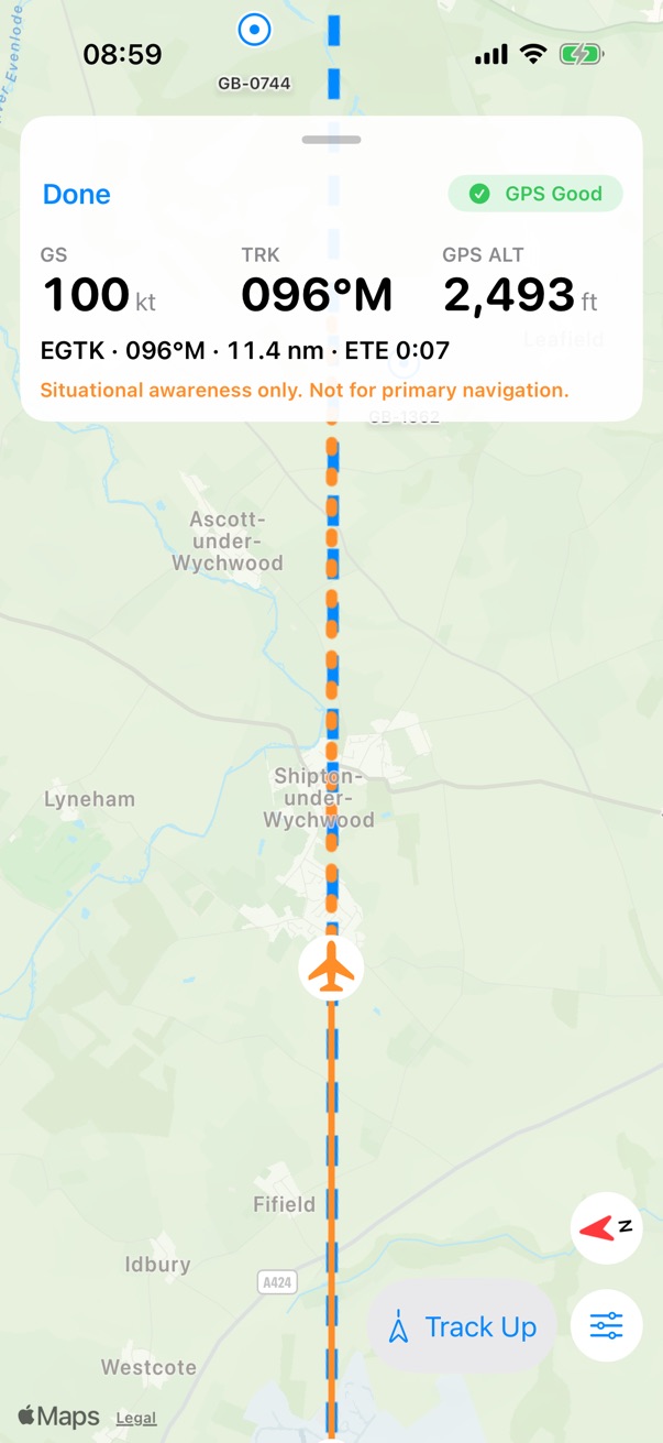
Step 5 of 8
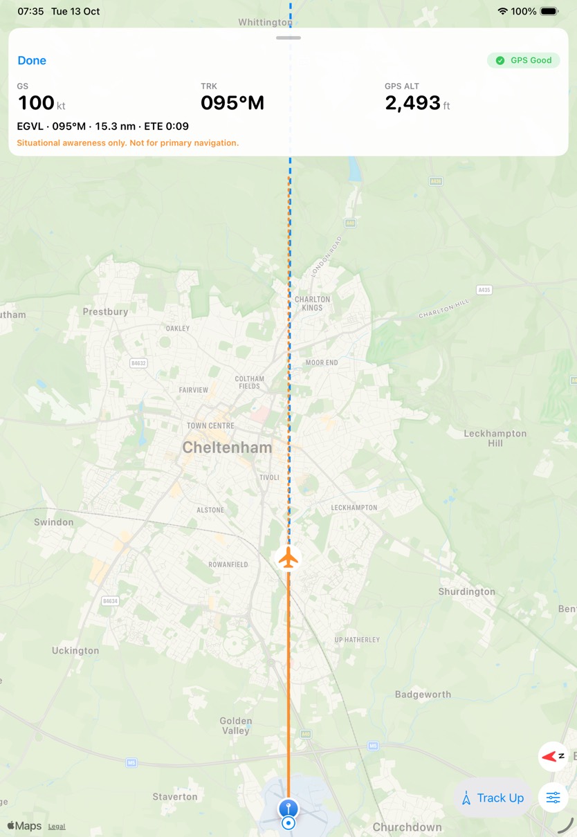
Moving map
Track Up or North Up, full screen.
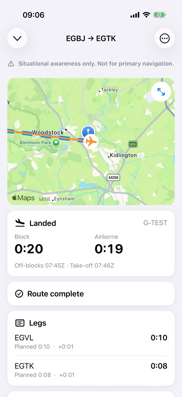
Step 6 of 8
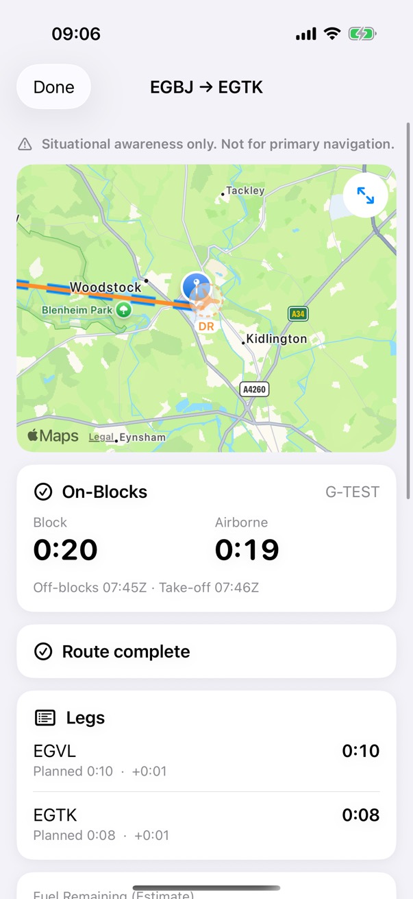
Landed
The landing is detected from GPS speed too, and each leg shows its time against the plan.
Step 7 of 8
On-blocks
Tap Finish (On-Blocks) when you stop.
Step 8 of 8
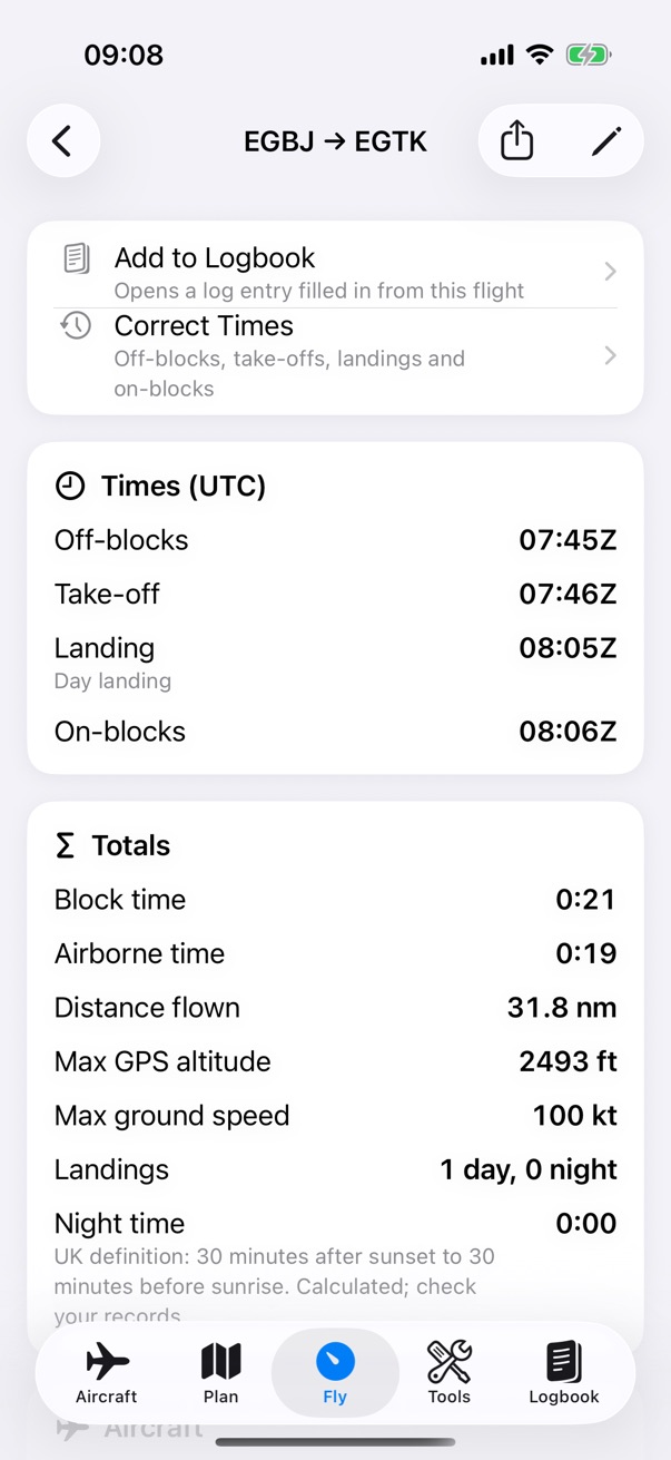
The record
The recorded flight keeps its times, take-offs, landings and GPS track. Add it to your logbook, or correct its times.
With a plan
Following the plan
With a flight plan, the app follows your legs. Without one, it shows your track, the timers and the nearest airports.
What it does
- Waypoint passages, each waypoint's ETA, and the next waypoint's distance, bearing and ETE, with the planned heading from the PLOG.
- Tap Waypoint to mark a passage yourself.
- An estimate of the fuel remaining, from the plan's fuel on board and its average burn.
How it works
Moving map
The moving map
A moving map, Track Up or North Up, that expands to full screen.
What it does
- Track Up or North Up.
- A track vector for 2 minutes ahead, or another length you choose.
- The planned route, your track and the nearest airports, on Apple Maps.
How it works
GPS
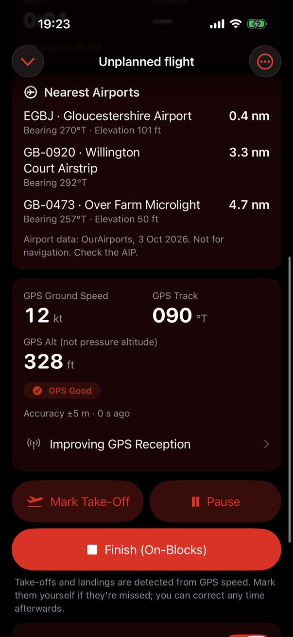
The GPS card
Ground speed, track, GPS altitude and the quality of the fix, and what the app does when the signal goes.
What it does
- When the signal is poor or lost, held and estimated values are marked on screen.
- Estimates are never recorded, and aren't for navigation.
- An external Bluetooth GPS receiver works with no set-up, and the card says when it is in use.
- Tips for a better signal are in the app, under the GPS card, and on the support page.
How it works
Step by step: when the signal goes
Step 1 of 6
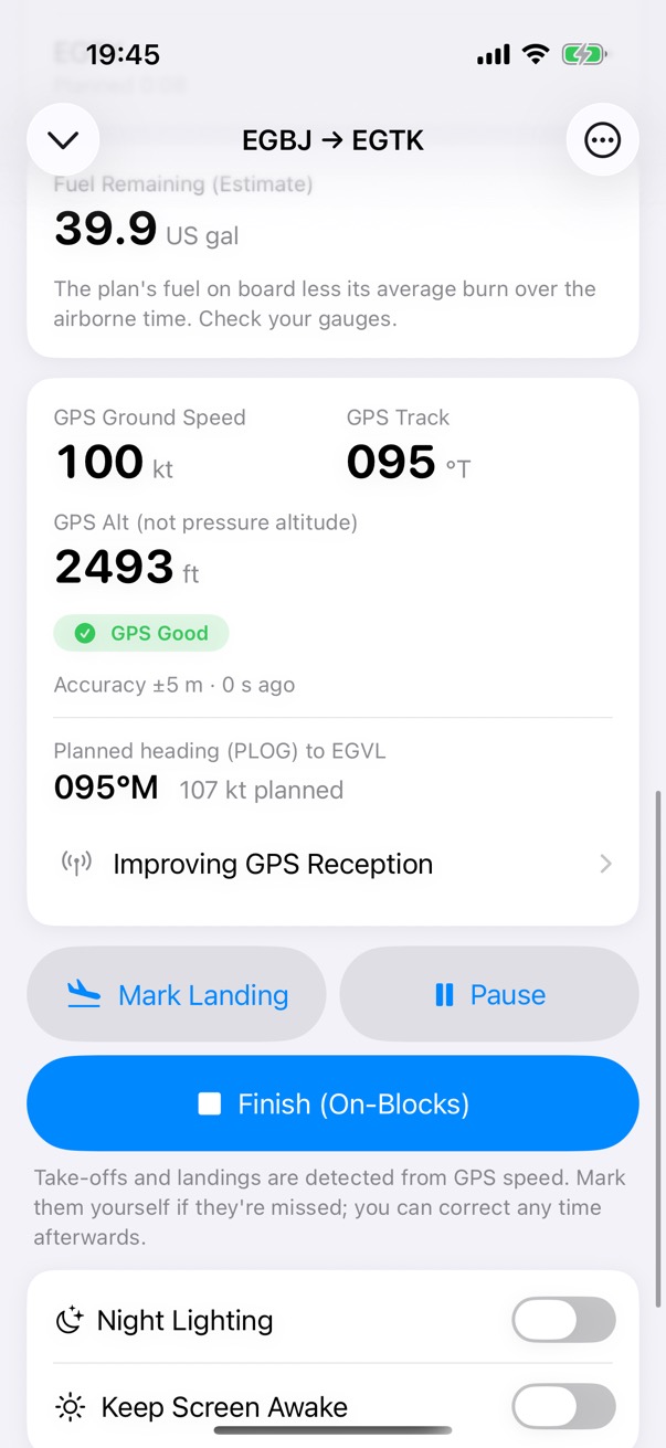
GPS Good
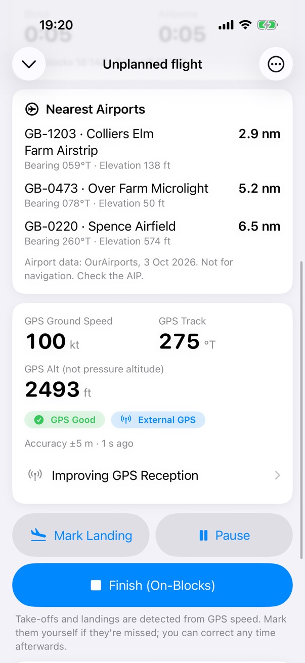
Ground speed, track and GPS altitude from the fixes, with their accuracy.
Step 2 of 6
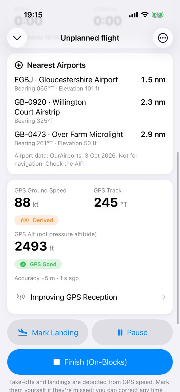
Derived
When the receiver gives no speed or track, they are worked out from the fixes and marked Derived.
Step 3 of 6
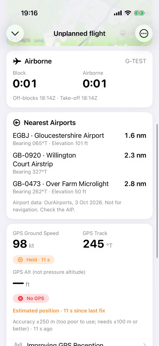
Held
Once the fixes stop, speed and track are held and marked with how long ago they came from the GPS.
Step 4 of 6
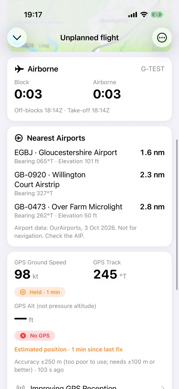
Estimated
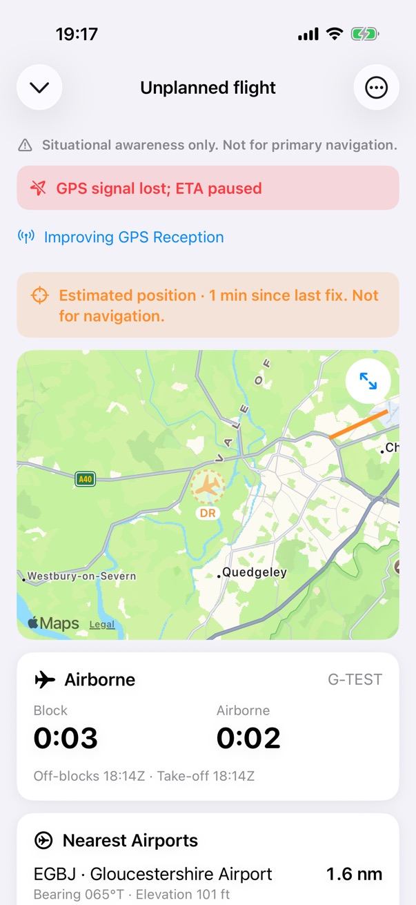
From about 10 seconds, the position is estimated from the last fix, your ground speed and your track, for up to 3 minutes.
Step 5 of 6
Signal lost
Banners say the signal is lost, the ETA is paused and the position is estimated. The map marks it.
Step 6 of 6
External GPS
A paired receiver gives fixes with no set-up, and the card shows External GPS.
In the cockpit
Night lighting and the cockpit tools
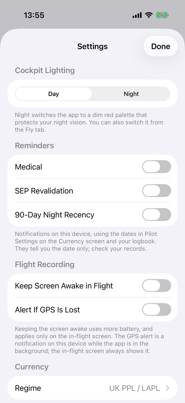
Turn on night lighting and the app switches to a red palette on a black background.
What it does
- Run your aircraft's checklists.
- A notepad for sketches and notes in flight.
- Night cockpit lighting: a red palette on a black background.
- Keep the screen awake while you fly.
How it works