Tools tab

Nine flight tools

Each on its own screen, for the sums pilots do on the ground and in the air. Choose a tool to see what it does, how it works and how to use it.

Planning aids. Check against your POH and the AIP. You remain responsible for the flight.

Choose a tool

Wind Correction

The heading to steer and the ground speed for a track, a TAS and a wind.

How it works

N Track 095°T · ground speed 119 kt Heading 100°T · TAS 107 kt Wind 240° at 15 kt 10 kt
The wind triangle, drawn to scale. To make good a 095°T track at 107 kt TAS with the wind from 240° at 15 kt, the app turns the heading 5° into the wind, to 100°T, and the ground speed comes out at 119 kt. The correction angle is the arcsine of the wind speed over the TAS times the sine of the wind's angle to the track.

How to use it

Steps
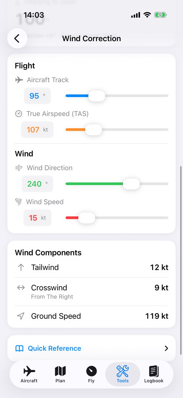
Wind Correction inputs: an aircraft track of 95 degrees, a TAS of 107 knots, and the wind from 240 degrees at 15 knots, with the wind components below: a 12 knot tailwind, a 9 knot crosswind from the right and a ground speed of 119 knots.

Step 1 of 2

Enter the track, TAS and wind

Set the aircraft track, the true airspeed and the wind, with the sliders or by tapping a value and typing. The wind's components show below.
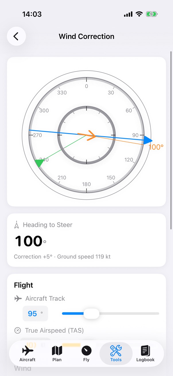
Wind Correction for a 095 degree track at 107 knots TAS with the wind from 240 degrees at 15 knots: heading to steer 100 degrees, a correction of plus 5 degrees, and a ground speed of 119 knots, with a compass showing the heading and the wind.

Step 2 of 2

Read the heading to steer

The heading to steer, the correction and the ground speed. The compass shows the heading, the track and the wind.

Cross Wind

The crosswind and headwind components for a runway.

How it works

26 Wind 240° at 15 kt Headwind 14.1 kt Crosswind 5.1 ktfrom the left 5 kt
The wind split into its parts, to scale. For runway 26 the wind from 240° is 20° off the runway: the headwind is the wind speed times the cosine of that angle, 14.1 kt, and the crosswind the speed times its sine, 5.1 kt from the left.

How to use it

Steps
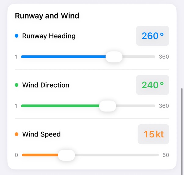
Cross Wind inputs: a runway heading of 260 degrees, and the wind from 240 degrees at 15 knots, each with a slider.

Step 1 of 2

Enter the runway and wind

Set the runway heading and the wind direction and speed. Or choose an airport, and the tool suggests the runway with the most headwind.
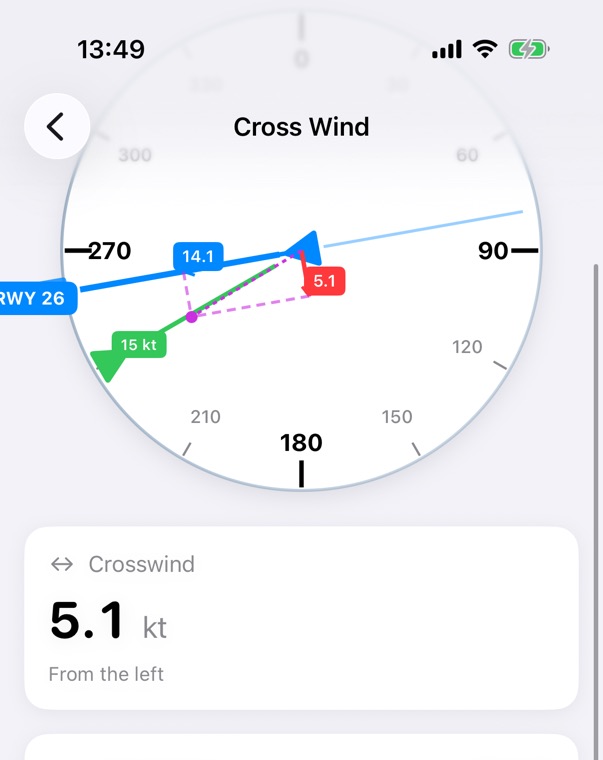
Cross Wind for runway 26 with the wind from 240 degrees at 15 knots: a compass with the runway, the wind and its components, and a crosswind of 5.1 knots from the left.

Step 2 of 2

Read the components

The crosswind, and the side it comes from, with the headwind. The dial shows the runway, the wind and its parts.

1 in 60 Rule

How far off track you are in degrees, the angle to close on your destination, and the heading to steer.

How it works

Departure Destination Planned track 095° 2 nm right 10.0° off track2 × 60 ÷ 12 nm flown 6.3° to close2 × 60 ÷ 19 nm to go Turn left 16.3°: new track 078.7°, then correct for the wind
The 1 in 60 rule: 1 nm off track after 60 nm is 1° off. Two nautical miles right after 12 nm flown is 10.0° off; closing on the destination 19 nm away needs 6.3° more. Turn left by both, 16.3°, onto 078.7°. The tool then adds the wind correction for the new track. Distances are to scale for exactly 2 nm; the screens below are set to just over 2 nm, so they show 10.1°.

How to use it

Steps
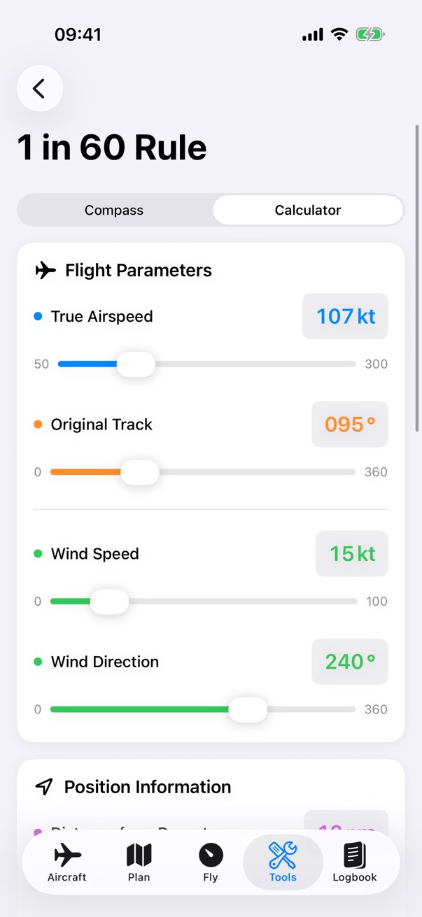
The 1 in 60 Rule calculator: the flight parameters, a TAS of 107 knots, an original track of 095 degrees, and the wind from 240 degrees at 15 knots.

Step 1 of 3

Flight parameters

Enter the TAS, the track you planned, and the wind.
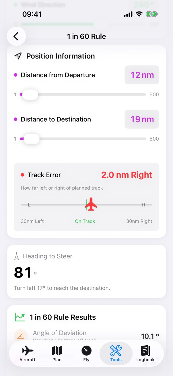
The 1 in 60 Rule position information: 12 nautical miles from departure, 19 to the destination, and the aircraft dragged to a track error of 2.0 nautical miles right.

Step 2 of 3

Where you are

Enter the distance flown from departure and the distance to go, then drag the aircraft to how far left or right of track you are.
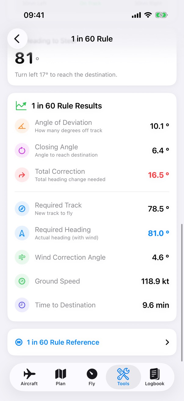
The 1 in 60 Rule results: a heading to steer of 81 degrees, turn left 17 degrees to reach the destination, an angle of deviation of 10.1 degrees, a closing angle of 6.4 degrees, a total correction of 16.5 degrees and a required track of 78.5 degrees.

Step 3 of 3

The heading to steer

The angle off track, the closing angle and the total correction, the new track, and the heading to steer with the wind.

Unit Converter

Conversions in eight groups: distance, speed, weight, volume, temperature, pressure, fuel and angle.

How it works

2,440 lb × 0.45359 1,106.76 kgthe base unit 1.10676 t 39,040 oz 1.22 short tons
Each group has one base unit, kilograms for weight, and each unit has a rate to it, so a value goes to the base and back out to any unit in the group. Temperature uses its own formulas. The Fuel group converts US gallons and litres to the weight of AVGAS or Jet A-1.

How to use it

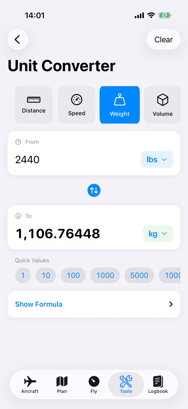
The Unit Converter set to weight: 2,440 pounds is 1,106.76448 kilograms, with quick values below.
  1. Choose a group, such as Weight.
  2. Type a value and choose its unit, then the unit to convert to.
  3. Quick values fill in common amounts, and Show Formula shows the sum.

Airspeed

Calibrated and equivalent airspeed and the Mach number, from your TAS, the air temperature and the pressure altitude.

How it works

Sea level, ISAdensity 100% 3,000 ft, 10 °Cdensity 91% TAS 107 kt EAS 102.2 kt CAS 102.2 kt EAS = TAS × √0.912Mach 0.163 = 107 ÷ 656 kt at 10 °C
Thinner air, a slower indicated speed. At 3,000 ft pressure altitude and 10 °C the air is 91% as dense as the ISA at sea level. EAS is TAS times the square root of that ratio, 102.2 kt. CAS also allows for compressibility, which is tiny at this speed; Mach is TAS over the speed of sound at the air temperature.

How to use it

Steps
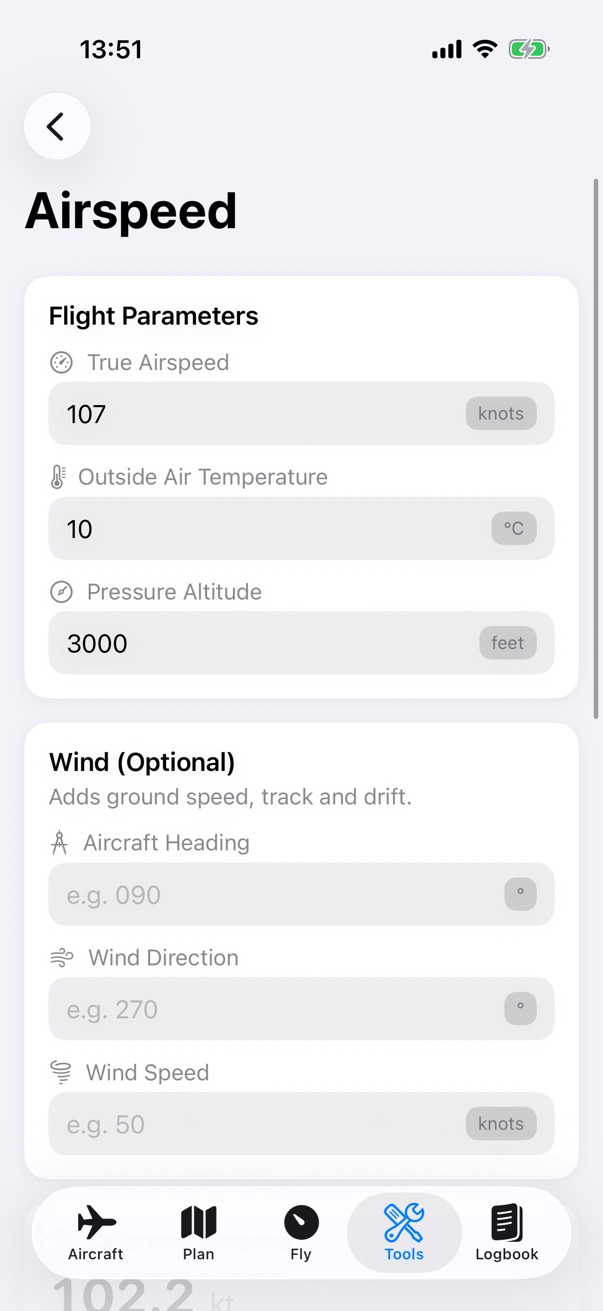
Airspeed inputs: a TAS of 107 knots, an outside air temperature of 10 degrees and a pressure altitude of 3,000 feet, with the optional wind fields below.

Step 1 of 2

Enter the TAS and the air

Enter the TAS, the outside air temperature and the pressure altitude. Add the wind and your heading for the ground speed, track and drift.
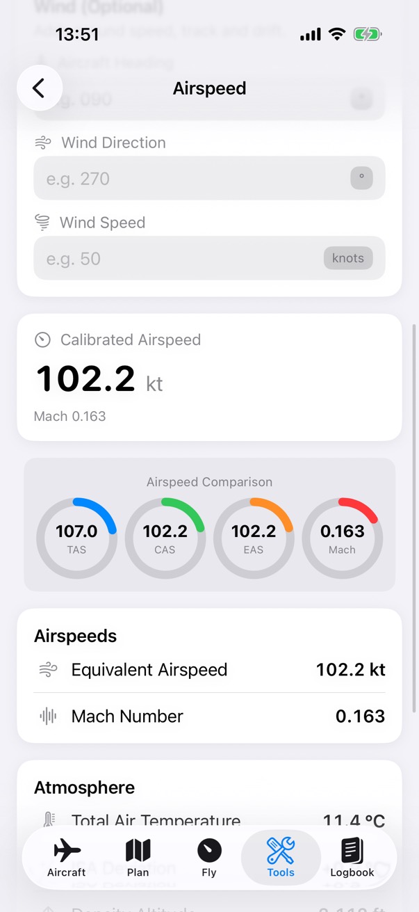
The Airspeed calculator for 107 knots TAS at 10 degrees and 3,000 feet: a calibrated airspeed of 102.2 knots, an equivalent airspeed of 102.2 knots and Mach 0.163.

Step 2 of 2

Read the airspeeds

The calibrated airspeed and Mach number, a comparison of TAS, CAS, EAS and Mach, and the atmosphere below.

Standard Altitude

Pressure and density altitude from the field elevation, the altimeter setting and the temperature, and the ISA standards for an altitude.

How it works

90 100 110 120 130 140 ft 101 Field 107 Pressure 133 Density +6 ft(29.92 − 29.91 inHg) × 1,000QNH 1013 hPa is 29.91 inHg +26 ft120 ft for each °C above ISA15 °C against ISA 14.8 °C Scale starts at 90 ft
Pressure and density altitude for a take-off from EGBJ at 101 ft, with a QNH of 1013 hPa and 15 °C. Pressure altitude adds 1,000 ft for each inch of mercury below 29.92; density altitude adds 120 ft for each degree the air is warmer than the ISA temperature at that altitude.

How to use it

Steps
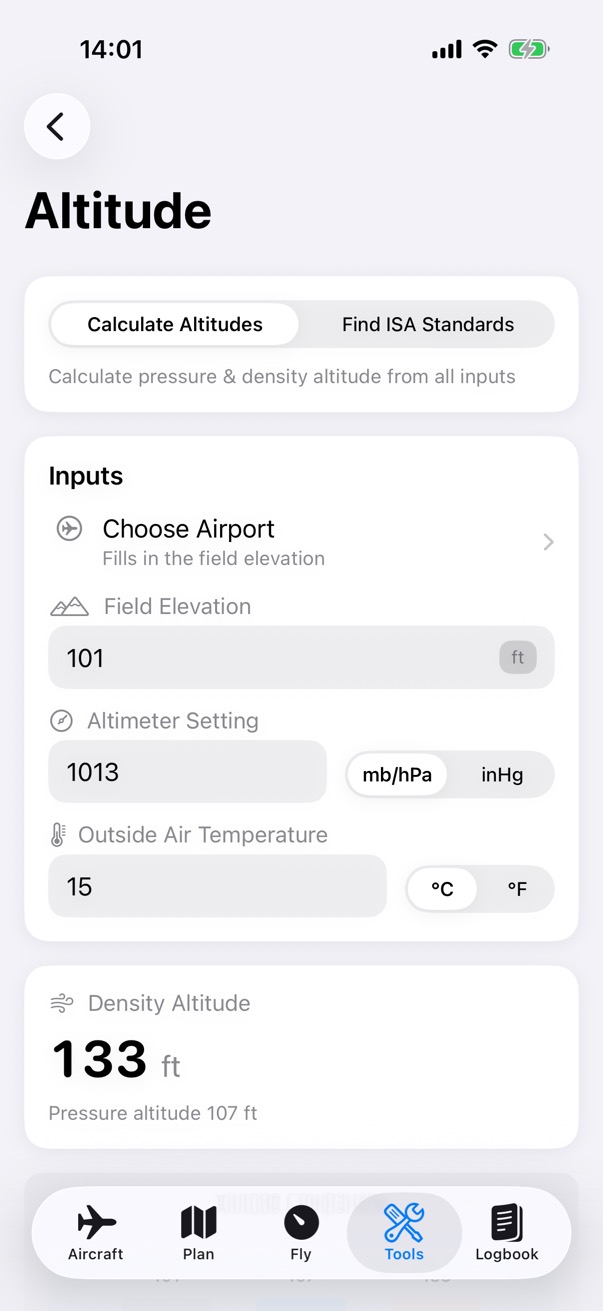
The Altitude calculator for a field elevation of 101 feet, 1013 hectopascals and 15 degrees: a density altitude of 133 feet and a pressure altitude of 107 feet.

Step 1 of 2

Enter the conditions

Enter the field elevation, or choose an airport to fill it in, the altimeter setting in hPa or inHg, and the temperature in °C or °F.
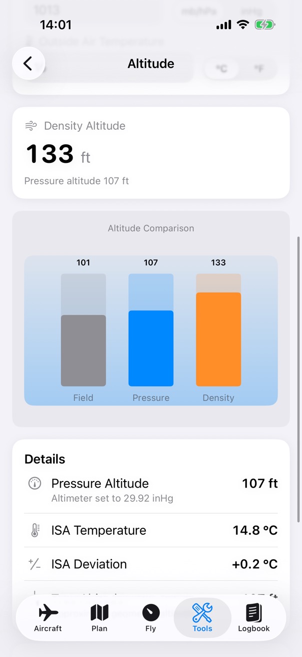
The Altitude results: a density altitude of 133 feet, a bar chart comparing the field elevation of 101 feet, the pressure altitude of 107 feet and the density altitude, and the details: an ISA temperature of 14.8 degrees and an ISA deviation of plus 0.2 degrees.

Step 2 of 2

Read the altitudes

Density and pressure altitude, a chart comparing them with the field elevation, and the ISA temperature and deviation.

Cloud Base

An estimate of the cloud base from the temperature and the dew point.

How it works

6° 8° 10° 12° 14° 16° 0 1,000 2,000 3,000 ft temperature, °C Air temperaturefalls about 3 °C a 1,000 ft Dew pointfalls about 0.5 °C a 1,000 ft Cloud base about 2,400 ft6 °C spread × 400 ft
Why 400 ft for each degree of spread. Rising air cools about 3 °C each 1,000 ft while its dew point falls about 0.5 °C, so the gap closes by 2.5 °C each 1,000 ft. With 15 °C and a dew point of 9 °C, they meet near 2,400 ft. It's an estimate only.

How to use it

Steps
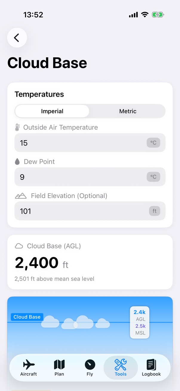
The Cloud Base calculator for 15 degrees with a dew point of 9 degrees at 101 feet: a cloud base of 2,400 feet above ground, 2,501 feet above mean sea level.

Step 1 of 2

Enter the temperatures

Enter the outside air temperature and the dew point, in imperial or metric, and the field elevation for the height above sea level.
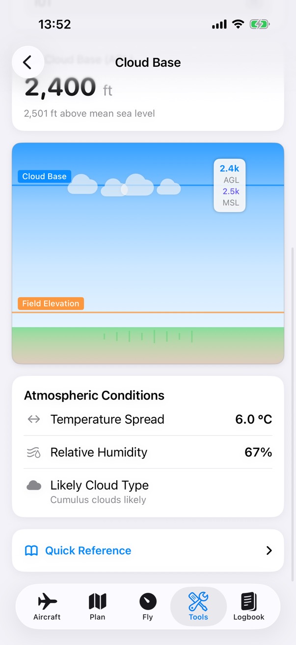
The Cloud Base results: 2,400 feet above ground with a picture of the cloud base over the field, a temperature spread of 6.0 degrees and a relative humidity of 67 percent.

Step 2 of 2

Read the estimate

The cloud base above the ground and above sea level, the temperature spread and the relative humidity.

Compass Heading

From a true heading to the magnetic and compass headings, with the variation and the deviation east or west.

How it works

094 095 096 097 098 099 100 101 102 True 100° Magnetic 099° Compass 097° −1° (1° E variation) −2° (2° E deviation) East is least, west is best: subtract east, add west.
From true to compass in two steps, on a heading tape. Take off east variation (add west) for magnetic, then east deviation (add west) for the compass heading.

How to use it

Steps
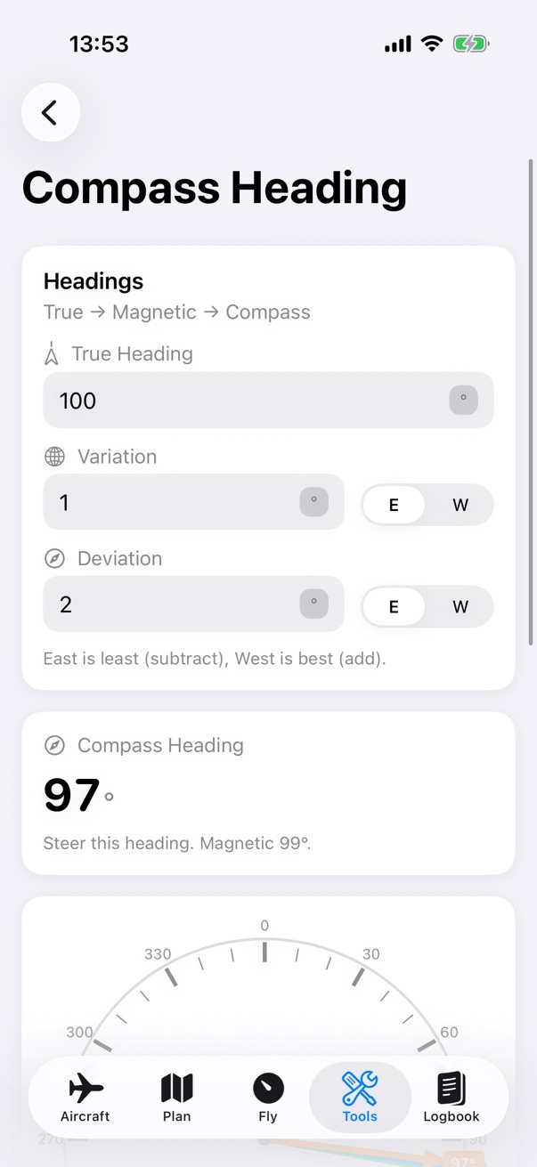
The Compass Heading calculator: a true heading of 100 degrees with 1 degree of variation and 2 degrees of deviation gives a compass heading of 97 degrees.

Step 1 of 2

Enter the headings

Enter the true heading, the variation and the deviation, choosing E or W for each. The compass heading to steer shows below.
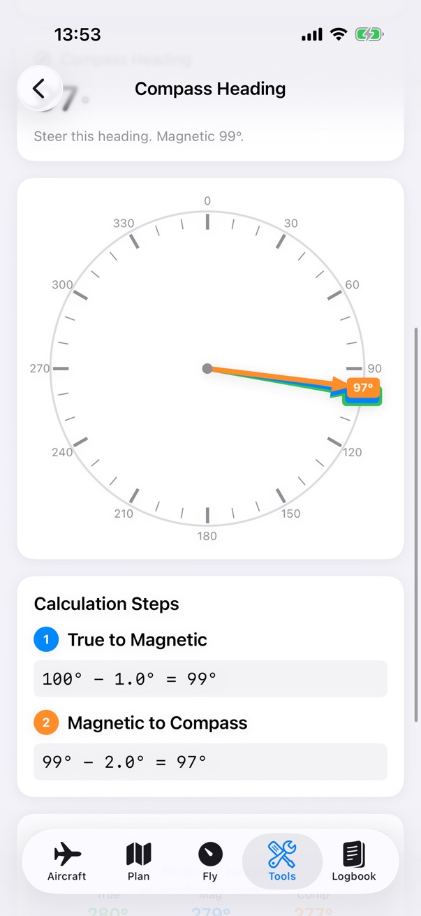
Compass Heading on a compass rose, with the calculation steps: true to magnetic, 100 minus 1 is 99 degrees, then magnetic to compass, 99 minus 2 is 97 degrees.

Step 2 of 2

See each step

A compass rose with the heading, and each step of the sum.

Scientific Calculator

A general-purpose calculator, with trigonometry in degrees or radians, powers, roots, logarithms and memory.

How it works

2 4 4 0 − 2 1 3 0 = 310 Loaded 2,130 lb Maximum 2,440 lb 310 lb spare
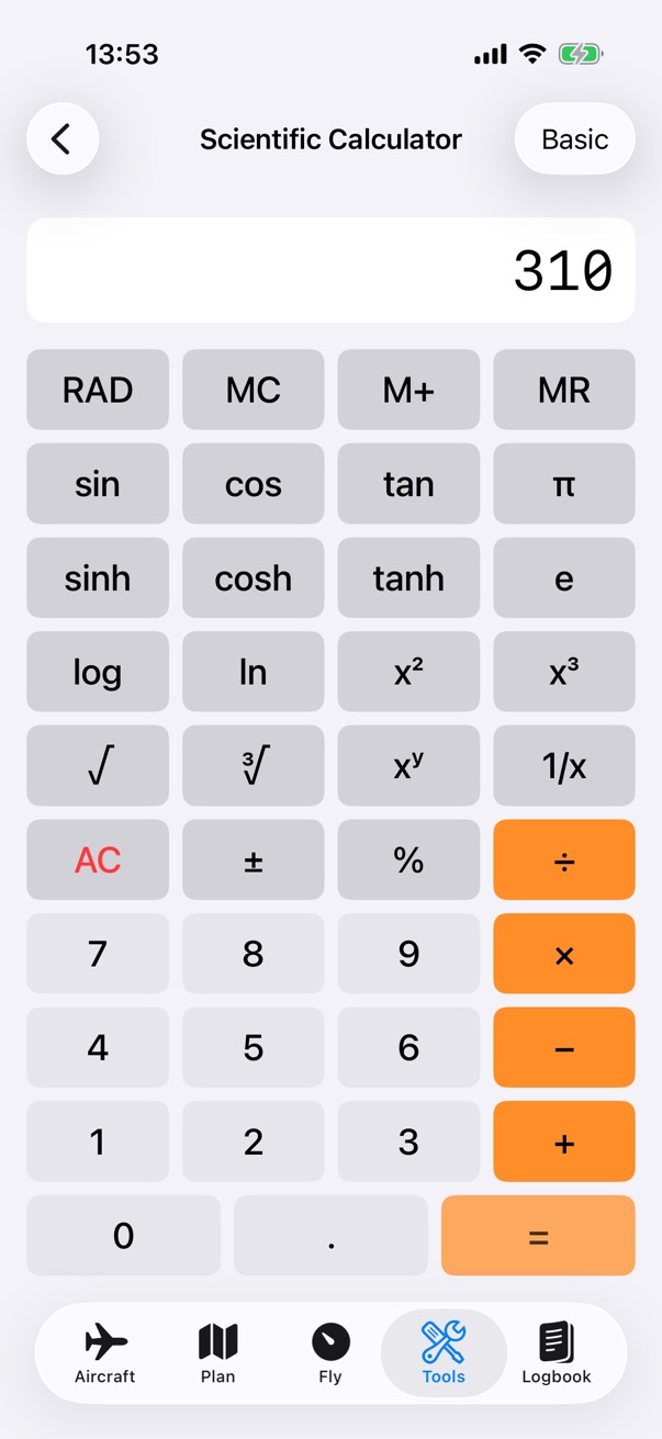
A general-purpose calculator for the sums pilots do: here the margin between the example aircraft's 2,130 lb loaded weight and its 2,440 lb maximum. It has trigonometry in degrees or radians, powers, roots, logs and memory.

How to use it

The Scientific Calculator showing 310, the difference between 2,440 and 2,130.
  1. Type the sum on the keypad.
  2. The scientific keys add trigonometry, powers, roots and logs, and the memory keys keep a value.
  3. The RAD or DEG key shows the angle unit; tap it to switch. Basic gives the simple keypad.
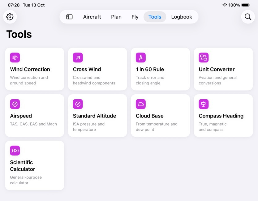
The Tools tab on iPad, four across: Wind Correction, Cross Wind, 1 in 60 Rule, Unit Converter, Airspeed, Standard Altitude, Cloud Base, Compass Heading and Scientific Calculator.
The Tools tab, on iPad.
NextLogbookFlights, totals and currency.