Plan tab

Plan the flight

Routes, legs and fuel, with the Weight & Balance and the performance for this flight, from the aircraft's own figures.

Planning aids. Check against your POH and the AIP. You remain responsible for the flight.

Routes

Plan on the map

Tap the map to place your departure, turning points and destination. A tap near an airport places it by its ICAO code.

What it does

  • Tap near a leg you have already drawn, and the app offers to add the waypoint into it.
  • Long-press a pin to drag it.
  • The runways and frequencies at the departure and destination, from the airport data.
  • The radio frequencies and navigation aids for the flight, from the stations you save.

How it works

1.5 nm EGVL Your tap Named from the map, or your own name Within 1.5 nm of an aerodrome: placed on it, by its ICAO code
How a tap becomes a waypoint. Within 1.5 nm of an aerodrome in the airport data, the waypoint goes on the aerodrome itself, named by its ICAO code. Anywhere else it's named from the map, or you give it a name.

Step by step: a new plan

Steps
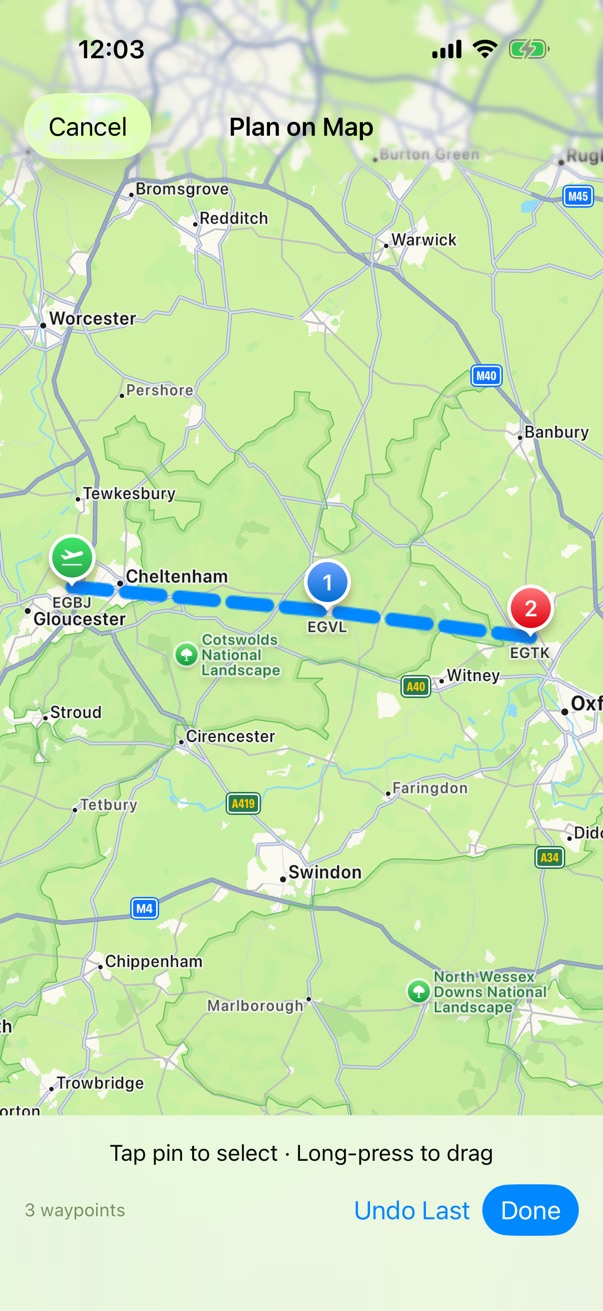
Plan on Map: the route from EGBJ through waypoint EGVL to EGTK drawn on Apple Maps, with buttons to undo the last waypoint or finish.

Step 1 of 6

Plan on Map

In the Plan tab, open Flight Plans and tap New Flight Plan. Enter the departure and destination and choose the aircraft, then tap Plan Route on Map and tap your turning points.
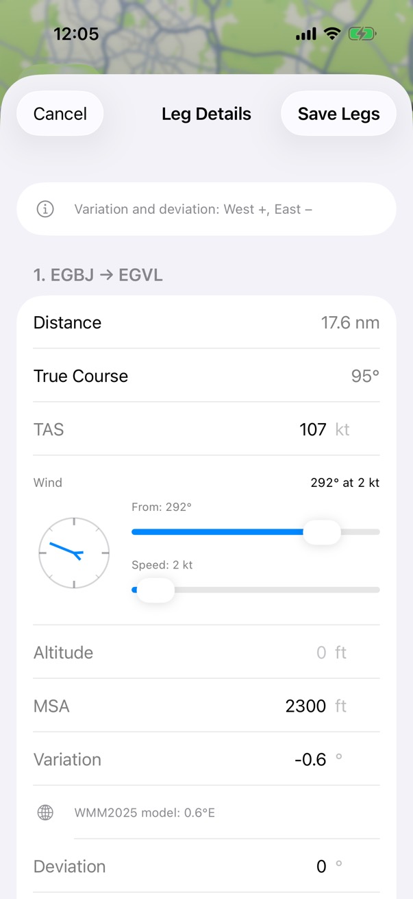
Leg Details for the leg from EGBJ to EGVL: 17.6 nautical miles on a true course of 095 degrees at 107 knots TAS, a wind dial and sliders, the MSA, and a variation of minus 0.6 degrees from the WMM2025 model.

Step 2 of 6

Leg Details

For each leg, enter the wind, altitude, MSA and compass deviation, then tap Save Legs.

How it works. The variation comes from the World Magnetic Model WMM2025, and you can change it.
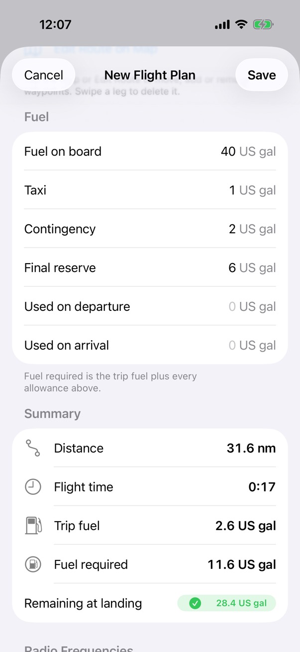
The fuel for the new flight plan: 40 US gallons on board, with taxi, contingency and final reserve, and a summary of 31.6 nautical miles, 17 minutes, 2.6 gallons trip fuel and 28.4 gallons remaining at landing.

Step 3 of 6

Fuel

Enter the fuel on board and the allowances for taxi, contingency and final reserve, then tap Save.
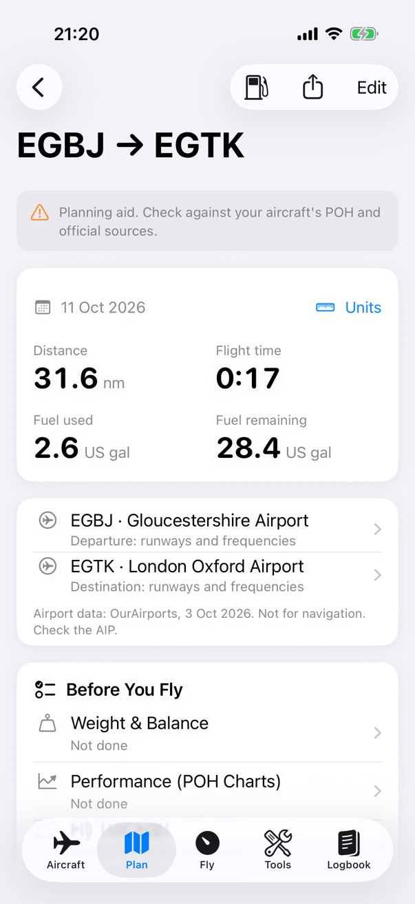
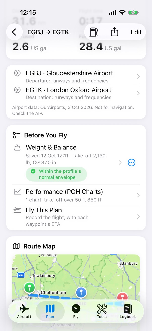
The flight plan for EGBJ to EGTK: 31.6 nautical miles, 17 minutes flight time, 2.6 US gallons used and 28.4 remaining, with the departure and destination airports and the Before You Fly list.

Step 4 of 6

The plan

Distance, time and fuel at a glance, the airports with their runways and frequencies, and the Before You Fly list.
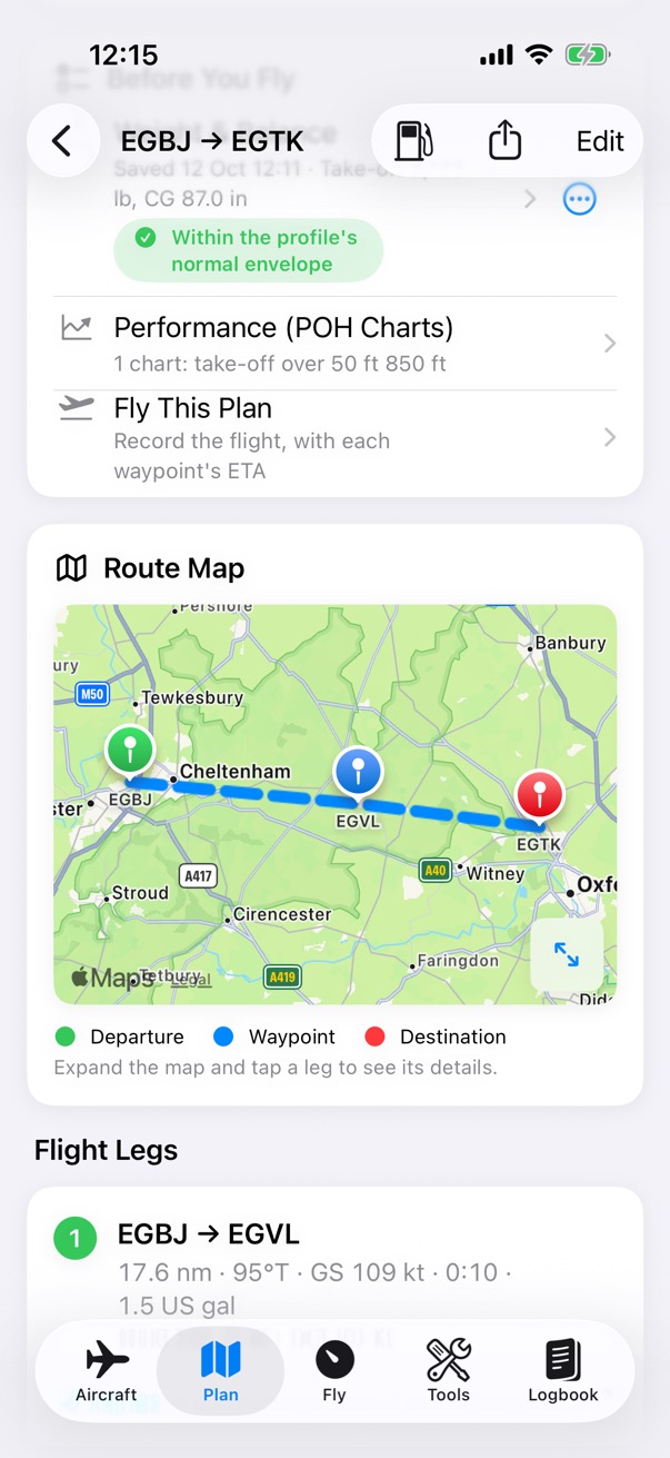
The flight plan's route map from EGBJ to EGTK via EGVL, above the list of flight legs. The first leg, EGBJ to EGVL, is 17.6 nautical miles on a true course of 095 degrees at a ground speed of 109 knots, taking 10 minutes and 1.5 US gallons.

Step 5 of 6

Route and legs

The route map, and each leg with its course, ground speed, time and fuel.
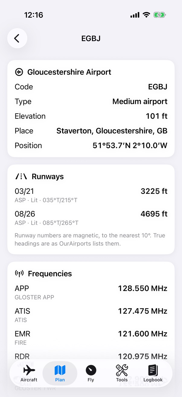
Airport data for EGBJ, Gloucestershire Airport, from OurAirports: a medium airport at an elevation of 101 feet in Staverton, its runways 03/21 of 3,225 feet and 08/26 of 4,695 feet, and the start of its frequencies list.

Step 6 of 6

Airport data

Runways and frequencies for each airport, from OurAirports. Check the AIP.
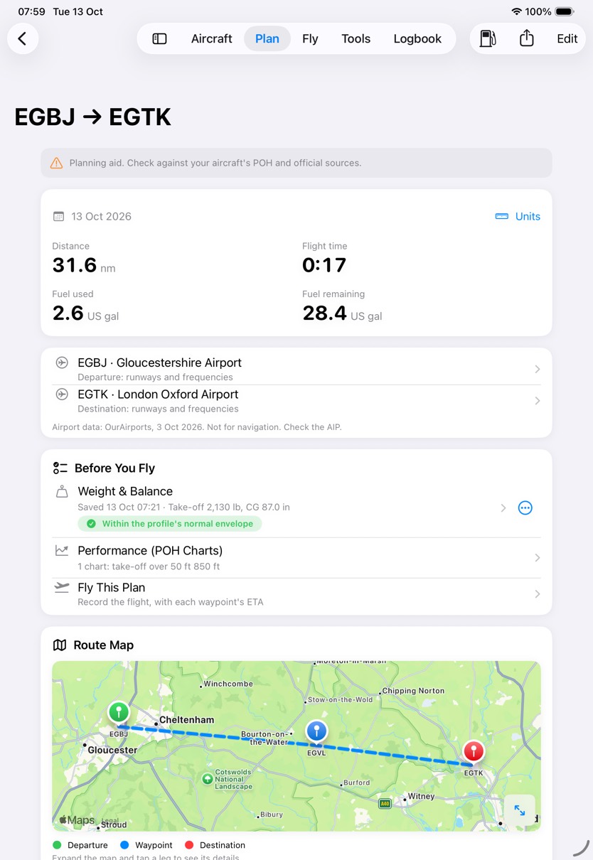
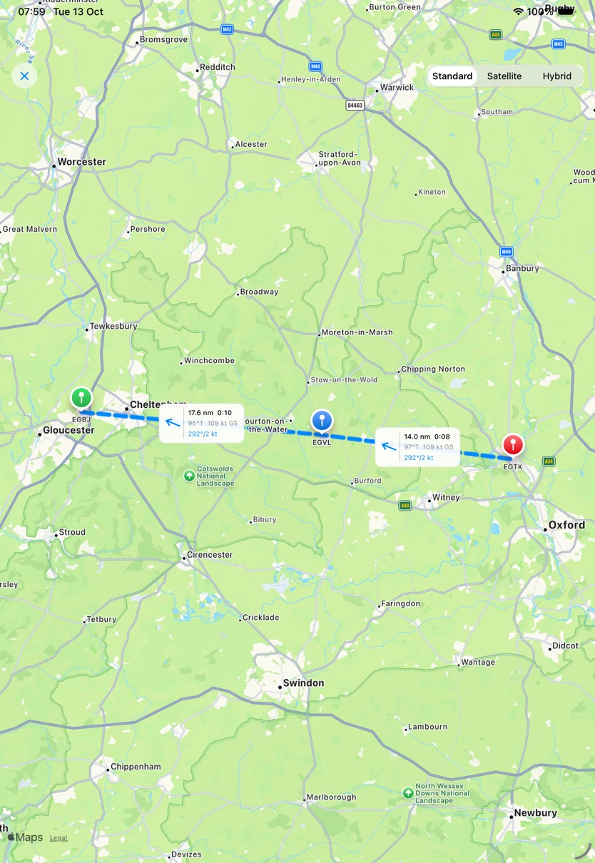
The EGBJ to EGTK flight plan on iPad: 31.6 nautical miles, 17 minutes, 2.6 US gallons used and 28.4 remaining, the departure and destination airports, Before You Fly with the Weight and Balance and the performance saved, and the route map.The plan's route map full screen on iPad, from EGBJ through EGVL to EGTK, with a label on each leg and a choice of standard, satellite or hybrid map.
The plan and its route map, on iPad.

Legs

Headings, speeds and times

Add each leg's wind and altitude, and the app works out the heading, the ground speed and the time.

What it does

  • Wind, altitude, MSA and compass deviation for each leg.
  • Magnetic variation for each leg from the World Magnetic Model WMM2025. You can change it.
  • The heading, ground speed and time for each leg, and the totals for the route.
  • A pilot log (PLOG) for the plan, as a PDF.

How it works

N Track 095°T · ground speed 119 kt Heading 100°T · TAS 107 kt Wind 240° at 15 kt 10 kt
The wind triangle, drawn to scale. To make good a 095°T track at 107 kt TAS with the wind from 240° at 15 kt, the app turns the heading 5° into the wind, to 100°T, and the ground speed comes out at 119 kt. The correction angle is the arcsine of the wind speed over the TAS times the sine of the wind's angle to the track.

Fuel

The fuel plan

Fuel on board, taxi, trip, contingency and final reserve, with what remains at landing. A fuel planner is built into each plan.

What it does

  • Trip fuel from each leg's time and the aircraft's fuel rate.
  • Allowances for taxi, contingency and final reserve, and for fuel used on departure and on arrival.
  • Fuel required: the trip fuel plus every allowance.
  • Remaining at landing: the fuel on board less the fuel required.

How it works

On board Required At landing 40.0 11.6 Trip 2.6 Taxi 1.0 Contingency 2.0 Final reserve 6.0 28.4 = 40.0 − 11.6 US gallons, to scale
The plan's fuel, to scale. Trip fuel is each leg's time at its ground speed times the fuel rate, here 2.6 US gal. Fuel required adds every allowance you enter. The app shows what's left as Remaining at landing: the fuel on board less the fuel required.

Weight & Balance

Weight & Balance for this flight

Enter the people, fuel and baggage to see the take-off weight and centre of gravity against the aircraft's envelope.

What it does

  • The take-off weight and centre of gravity, against the normal and utility envelopes.
  • The Weight & Balance after the fuel you expect to burn: give the flight time and burn rate, and choose which tanks it comes from.
  • Save both results with the flight plan, for the pilot log and the plan file.

How it works

84868890921,2001,6002,0002,400 CG arm (in) lb NORMAL CATEGORY Take-off2,130 lb · 87.01 in Landing2,048.9 lb · 86.69 in
Weight & Balance for the example flight, to scale. Each item's weight times its arm is its moment; the total moment over the total weight is the centre of gravity, 87.01 in at 2,130 lb. After 1.5 hours at 9 US gal an hour, 13.5 gallons of AVGAS (6.01 lb a gallon, 81.1 lb) come off at the fuel arm, so the CG moves forward to 86.69 in.

Step by step: the load

Steps
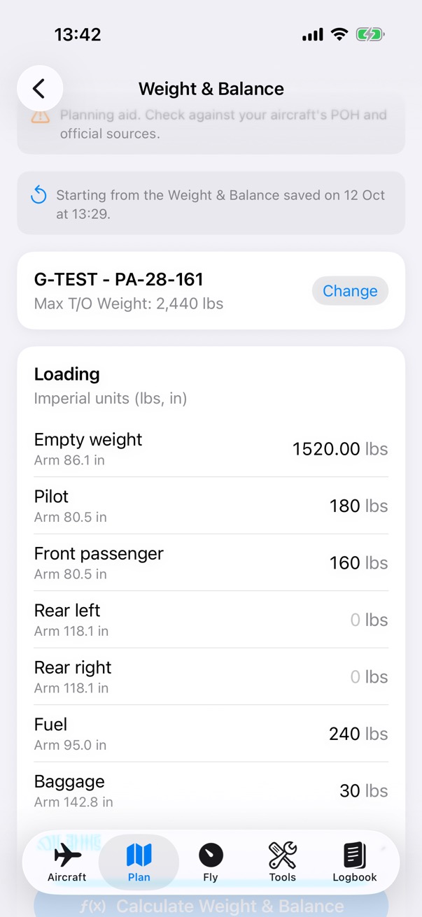
Weight and Balance for G-TEST, a PA-28-161 with a maximum take-off weight of 2,440 pounds: the loading list with the empty weight, pilot, front passenger, rear seats, fuel and baggage, each with its arm.

Step 1 of 4

The load

People, fuel and baggage, each at its arm from the aircraft profile.
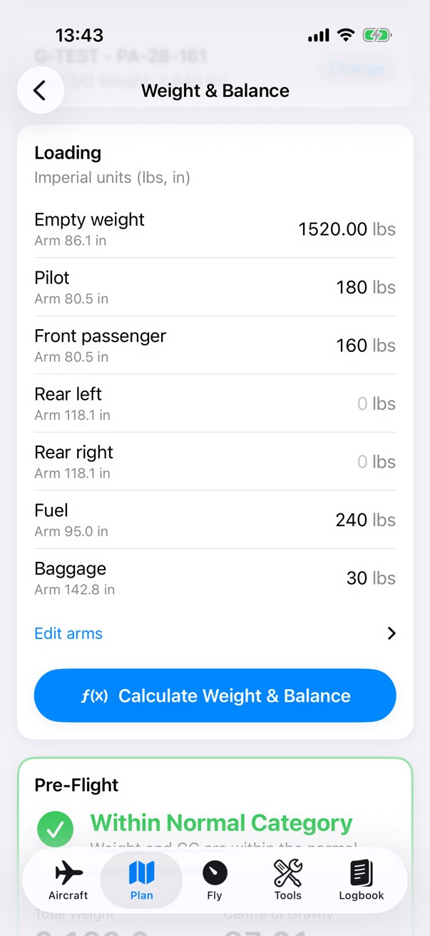
The Weight and Balance loading list for G-TEST and the pre-flight result below it: within the normal category, with a total weight of 2,130 pounds and the centre of gravity at 87.01 inches.

Step 2 of 4

Take-off

Calculate Weight & Balance gives the total weight and the centre of gravity: 2,130 lb at 87.01 in for the example flight.
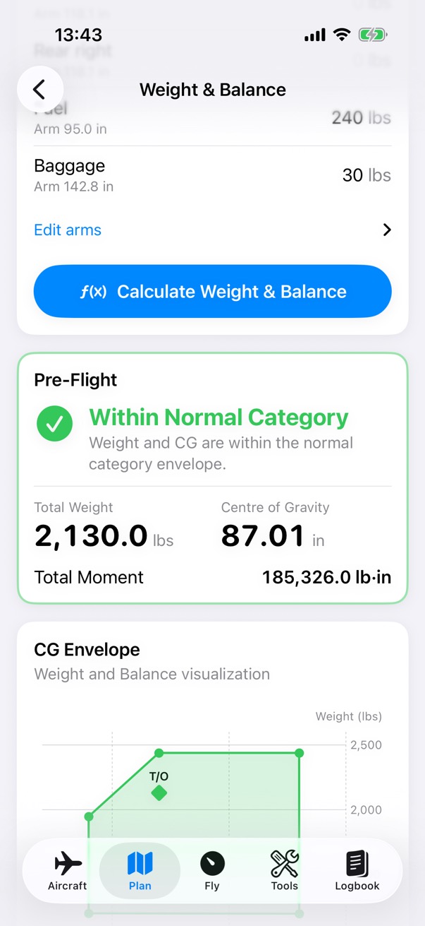
The CG envelope chart in the Weight and Balance result, with the take-off point marked inside the normal envelope.

Step 3 of 4

The envelope

The take-off point, on the aircraft's envelope.
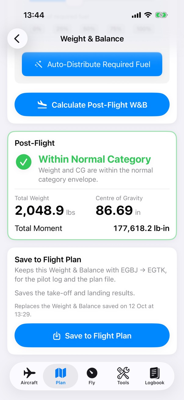
The post-flight Weight and Balance after 1.5 hours at 9 US gallons an hour, 13.5 gallons taken from the main tank: within the normal category, with a total weight of 2,048.9 pounds and the centre of gravity at 86.69 inches, and the button to save both results to the flight plan.

Step 4 of 4

Landing

Calculate Post-Flight W&B takes off the fuel you expect to burn. Save to Flight Plan keeps both results with the plan.
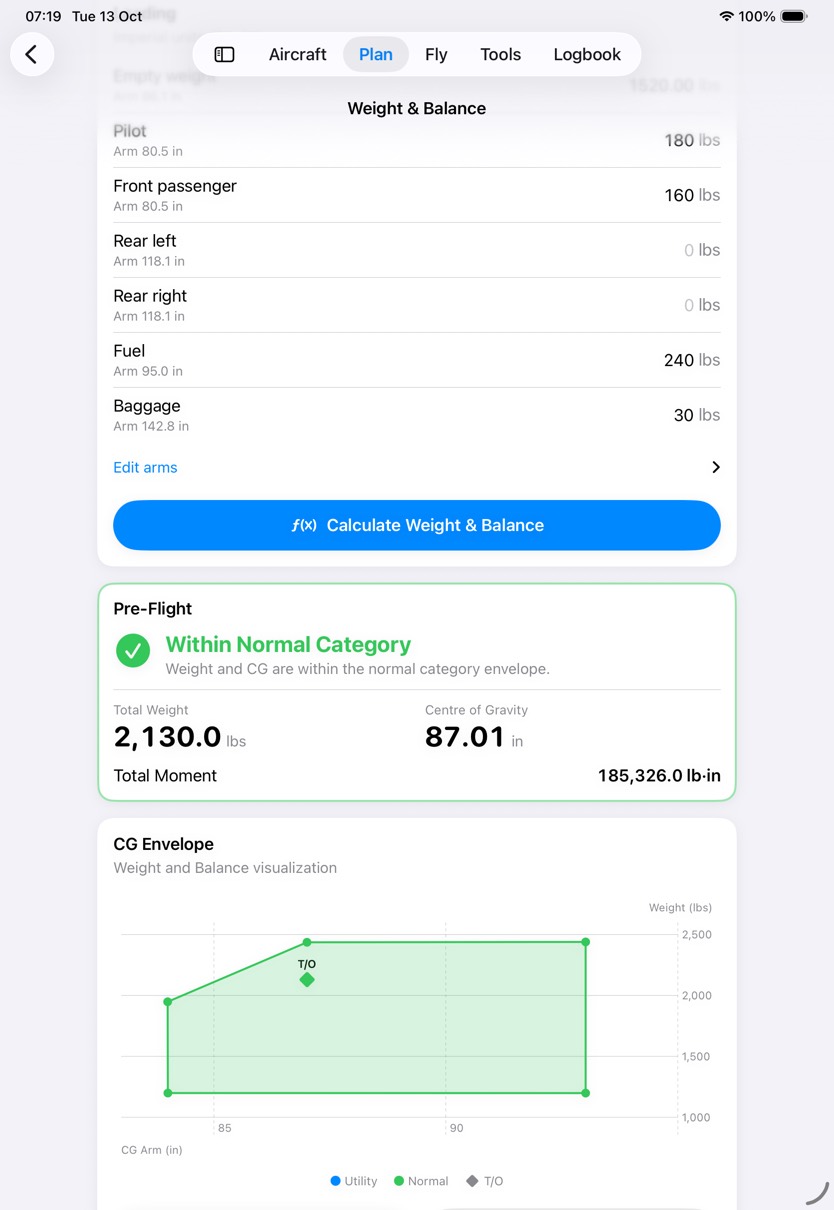
Weight and Balance on iPad for G-TEST: the loading list, the pre-flight result within the normal category at 2,130 pounds with the centre of gravity at 87.01 inches, and the CG envelope with the take-off point.
Weight & Balance, on iPad.

Performance

Performance for this flight

The plan brings the aircraft's POH charts together with the airports and the day's conditions. You trace each chart and record what you read.

What it does

  • The departure and destination with their elevations and runway lengths, from the airport data.
  • Pressure and density altitude for the take-off, from the QNH and temperature you enter.
  • The take-off and landing weights, from the Weight & Balance saved to the plan.
  • Tracing a chart here saves it to this plan only. The aircraft's own charts don't change.

How it works

90 100 110 120 130 140 ft 101 Field 107 Pressure 133 Density +6 ft(29.92 − 29.91 inHg) × 1,000QNH 1013 hPa is 29.91 inHg +26 ft120 ft for each °C above ISA15 °C against ISA 14.8 °C Scale starts at 90 ft
Pressure and density altitude for a take-off from EGBJ at 101 ft, with a QNH of 1013 hPa and 15 °C. Pressure altitude adds 1,000 ft for each inch of mercury below 29.92; density altitude adds 120 ft for each degree the air is warmer than the ISA temperature at that altitude.

Step by step: performance

Steps
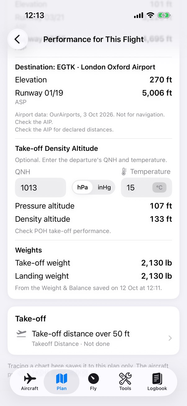
Performance for This Flight: the destination EGTK at 270 feet with runway 01/19, the take-off density altitude from a QNH of 1013 and 15 degrees, a pressure altitude of 107 feet and a density altitude of 133 feet, and the take-off and landing weights.

Step 1 of 2

The conditions

Enter the QNH and temperature for the take-off. The app works out the pressure and density altitude.
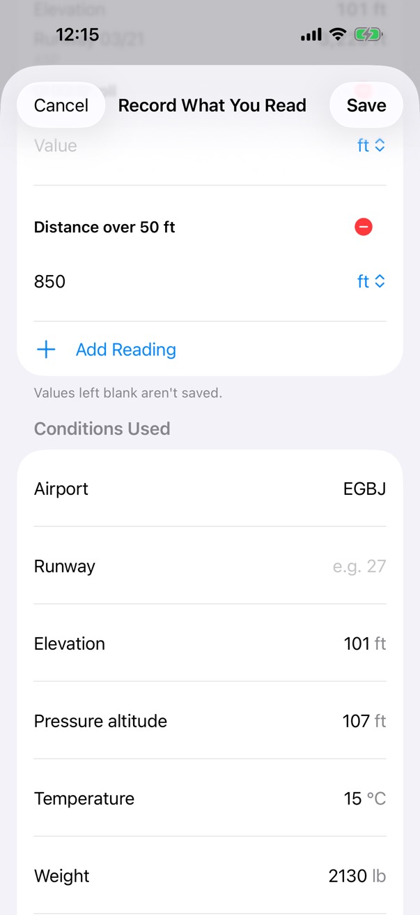
Record What You Read: a distance over 50 feet of 850 feet, and the conditions used, filled in from the plan: EGBJ, an elevation of 101 feet, a pressure altitude of 107 feet, 15 degrees and 2,130 pounds.

Step 2 of 2

Record what you read

Trace the aircraft's chart for this flight, then record the value you read and the conditions you used: the runway, temperature, weight, wind, surface and slope.

How it works. The app fills in what it knows from the plan.

Before you go

Before You Fly and the pilot log

Each plan's Before You Fly card shows whether the Weight & Balance and the performance are done, and says if the plan or the aircraft has changed since.

What it does

  • Both results go on the pilot log (PLOG), with every value from a chart labelled as your own reading.
  • Share the plan with or without its Weight & Balance (which includes the weights of the people on board) and its performance readings.
  • The route as a GPX file.
  • Fly This Plan starts the flight from here.

How it works

Before You Fly Weight & BalanceSaved · 2,130 lb, CG 87.0 in Performance (POH charts)Saved · take-off over 50 ft 850 ft Fly This Plan You move awaypoint The plan has changed since this was saved
Each saved result remembers the plan and the aircraft it was worked out for. Change either, for example by moving a waypoint, and Before You Fly says the result may be out of date, so you can redo it.

Step by step: ready to go

Steps
The EGBJ to EGTK flight plan's Before You Fly card, with the Weight and Balance and the performance from the POH chart both saved, and Fly This Plan.

Step 1 of 4

Before You Fly

The card lists what is done, with a short summary of each.

How it works. Each saved result remembers the plan and the aircraft it was worked out for.
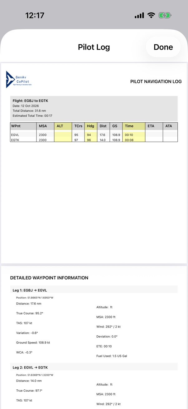
Page one of the pilot log PDF for EGBJ to EGTK: the flight summary and the navigation log table, with each leg's MSA, track, heading, distance, ground speed and time.

Step 2 of 4

The pilot log

The PLOG as a PDF: the flight summary and the navigation log, with each leg's MSA, track, heading, distance, ground speed and time.
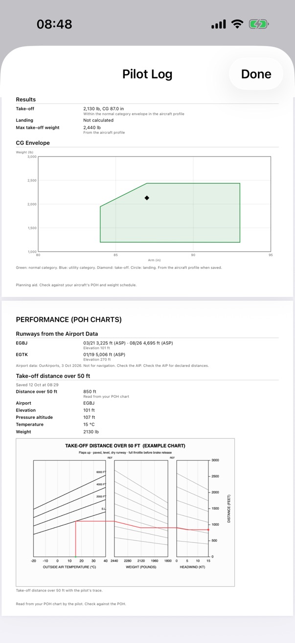
Later pages of the pilot log PDF: the Weight and Balance results with the CG envelope, and the performance page with the runways from the airport data and the traced example chart.

Step 3 of 4

Its other pages

The Weight & Balance with the envelope, and the performance page with the runways and the traced chart.
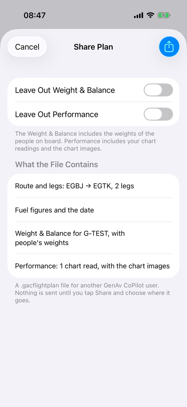
The Share Plan screen: switches to leave out the Weight and Balance and the performance, and what the file contains: the route and two legs, the fuel figures and the date, the Weight and Balance for G-TEST with people's weights, and one chart read with its images.

Step 4 of 4

Share the plan

The share screen lists exactly what the file contains before you send it.

NextFlyRecord the flight, from off-blocks to on-blocks.